
TMAP Mobility announced on the 27th that it will begin providing fog information through its TMAP platform.
This is the first time that fog warning zones will be displayed in real-time on a comprehensive mobility platform.
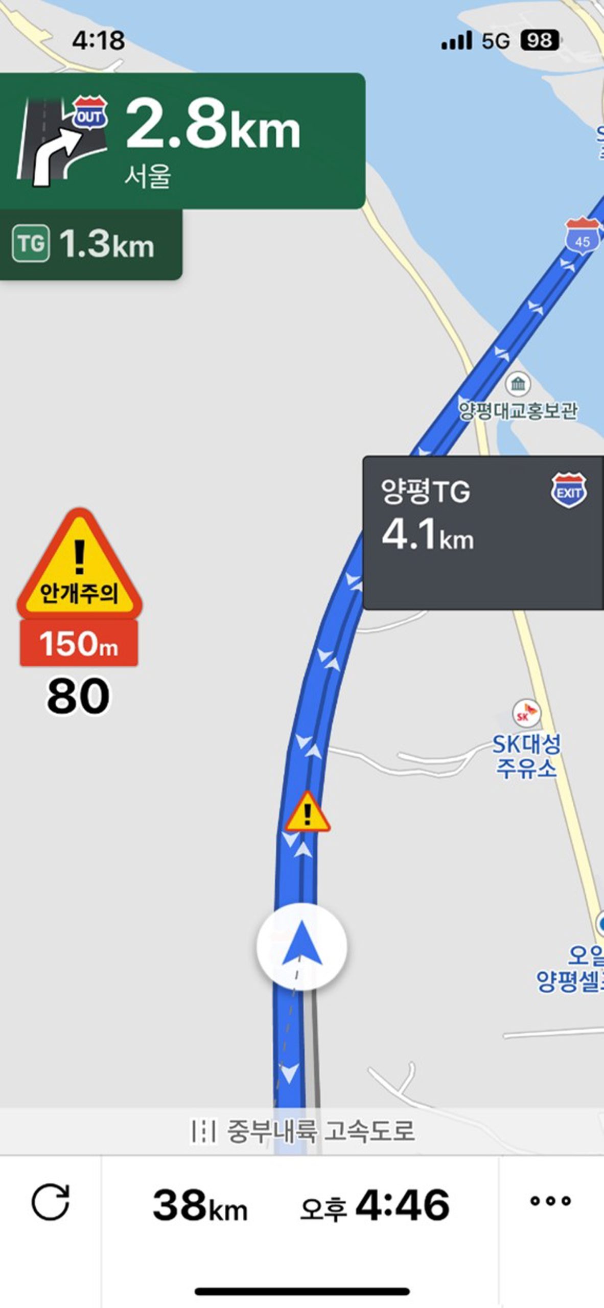
The fog information will utilize data from the Korea Meteorological Administration’s road weather observation network. A comprehensive approach employing remote sensing technology from weather satellites, visibility measurement using visibility meters, and artificial intelligence applied to closed-circuit television (CCTV) footage will provide information that guides drivers using voice alerts and sign images.
TMAP will notify drivers of danger information 300 meters before entering foggy zones. The service will gradually expand throughout the year, starting with the Jungbu Inland Expressway.
Yu Hee-dong, head of the Korea Meteorological Administration, stated, “Traffic accidents caused by low visibility due to fog can lead to major incidents such as rear-end collisions, making preemptive information for maintaining safe distances essential. The road visibility hazard information service will significantly contribute to ensuring public safety and reducing the social costs associated with traffic accidents.”
Kim Yong-hoon, head of the AIM Services team at TMAP Mobility, emphasized, “When dense fog occurs, it can be challenging to see ahead, posing a significant risk to drivers, akin to icy roads. We aim to provide optimal navigation services while simultaneously safeguarding driver safety with real-time road weather information.”
Lee Sang-jin daedusj@autodiary.kr